Home Page Navigation
Home Page Navigation Block
Featured News
 Chinook salmon. (Credit: NOAA Fisheries)
Feature Story
Microsoft Provides AI and Cloud Computing for NOAA Project to Better Map Prime Salmon Habitat
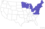
West Coast
 Caption: Field camp at sunrise on Tern Island, Lalo. Credit: NOAA Fisheries (Permit #PMNM-2024-001)
 A white marlin tagged with a spaghetti tag, getting ready to be released. Photo courtesy of Chris Jobes.
Feature Story
Celebrating our Top Taggers for Citizen Science Month
New England/Mid-Atlantic
Southeast
 NOAA Fisheries Assistant Administrator Eugenio Piñeiro Soler. Credit: NOAA Fisheries
 Excavating a new channel for McCoys Creek to replace an 850-foot tunnel that forced the creek underground. Credit: City of Jacksonville
 Two North Pacific right whales photographed from the NOAA Ship Oscar Dyson in August, 2021, during a survey in Alaska. Photo taken under NOAA Fisheries Research Permit #20465.
Notices & Rules
Protected Resources
Protected Resources
Fisheries
Protected Resources
Fisheries
Upcoming Events
Bulletins
Open Funding Opportunities
Find a Species


Explore By Region


Explore by Topic
- Aquaculture
- Bycatch
- Careers & More
- Chesapeake Bay
- Climate Change
- Commercial Fishing
- Consultations
- Ecosystems
- Endangered Species Conservation
- Enforcement
- Fishery Observers
- Habitat Conservation
- International Affairs
- Laws & Policies
- Marine Life in Distress
- Marine Life Viewing Guidelines
- Marine Mammal Protection
- Offshore Wind Energy
- Partners
- Population Assessments
- Recreational Fishing
- Recreational Fishing Data
- Resources for Fishing
- Seafood Commerce and Trade
- Socioeconomics
- Sustainable Fisheries
- Sustainable Seafood
- Teacher at Sea Program
Multimedia

 GulfCorps crews clear vegetation to restore habitat in Florida. Credit: The Nature Conservancy/John Stanmeyer